Monday, March 29, 2021

What the people of Ottawa are losing.

 Height restrictions on buildings near Parliament Hill; in the Western Annex(Lebreton Flats) and historic neighbourhoods.

Motor vehicles on the scenic parkways---Sir John A. Macdonald; Sir George Etienne Cartier; Queen Elizabeth Drive. Eventually the parkways will be depaved.

Motor vehicles on Wellington Street in front of the Hill and that includes tour buses.

Shopping malls---Billings Bridge; Westgate; Lincoln Fields, Herongate.

 The ban on redevelopment of the Greenbelt.

 Recreational centres and land:

1.) Tom Brown Arena, 141 Bayview Road, along the easterly limits of Mechanicsville and Hintonburg, south of both Albert and Scott Streets. 1.8 ha. Height Limit-11 m but not for residential. Site was former CP Rail Yard including roundhouse and several rail lines|sidings...Land zoned Community Leisure Facility cannot be developed for residential without a Zoning By-Law Amendment. 

2.) Bob MacQuarrie Recreational Centre, 1490 Youville Drive. Located in the former City of Gloucester just south of Highway 174 and Jeanne d'Arc interchange along the westerly limits of the community of Convent Glen South. 4.3 ha. Height Limit-15 m but not for residential. 

3.) RCGT Park baseball stadium, 300 Coventry Road. The site is located in the community of Overbrook south of Coventry and northeast of the Vanier Parkway and Highway 417(the Queensway).6.664 ha. Requirement to disengage from stadium uses.

4.) The Dalhousie Community Centre, 755 Somerset Street West was recently given away.`

The Dominion Observatory Campus on Carling. The Classified Heritage Buildings may collapse when blasting for the adjacent medical centre occurs. Astronomer Arthur Covington wrote a letter to Prime Minister Pierre Trudeau in 1970, asking the Prime Minister to save the Astrophysical Observatory which he did. 

 Agriculture Minister John Wise was totally against the privatization of the 91-acre Clyde/Merivale property: House of Commons, Ottawa May 13, 1988: "Agriculture Canada, my Department, has no plans or thoughts whatsoever of disposing of any portion of that property at any time. There is no question about that." Laurentian High School land at Clyde and Baseline is now owned by Walmart.

Parks that are larger than a hectare. Jacques Greber in 1950 stated that the National Capital has so much land that publicly-owned and vast expanses of green space should be accessible for everyone. Especially for families who live in apartments and do not have backyards. 

Sunday, March 28, 2021

The Farm.

My younger sister and I visit our grandfather's abandoned farm, located between Merrickville and Jasper, Ontario. 1964.

Leave Parliament Hill alone.

 Who is digging a giant crater in front of the Centre Block of Parliament? Why is the city building Light Rail infrastructure on the Hill?

The Holt Report of 1915, page 111: "Parliament Hill, because of the importance of its buildings and its natural elevation, is and always must be the dominant feature of Ottawa. All other parts of the Government group must be subordinated to this, architecturally as well as actually, and instead of rivalling or competing it should increase its relative importance and enhance the beauty and dignity of its buildings."

A CBC News image from June 18, 2020.
"The Hill", The People's Park, Canada's Park, My Park.

New Official Plan-Engage Ottawa November 20, 2020.

City of Ottawa Official Plan. Volume 2A: Urban Secondary Plans.

Alta Vista/Faircrest/Riverview Park Secondary Plan.

Bank Street South Secondary Plan. The Billings Bridge Shopping Centre will no longer exist: "...The shopping centre site should become a transit-oriented neighbourhood with retail, streets and residential and office towers organized around a system of streets and blocks centred on a park...""A master concept for the entire Billings Bridge shopping centre site shall be submitted with proposed development when the FSI for the site exceeds 1.0. The master concept plan shall demonstrate how the redevelopment will unfold to meet the city's intensification targets." (Pages 10 and 11.)

 Parking lots facing Bank Street even on private property will be phased out. High rise and mid rise condominiums will be constructed along, and adjacent to the Rideau River.( My comment- Sections of land along the Rideau River in Ottawa are untouchable, read the 1950 Greber Report; the 1988 National Interest Land Mass document and "Definition and Assessment of Cultural Landcapes of Heritage Value on NCC Lands"---Small Scale Cultural Landscapes within the Rideau River Corridor:

  • Rideau Falls
  • Hog's Back Falls and Vincent Massey Park.
  • Riverside Drive Corridor. (Information about Cultural Landscapes within the Rideau River Corridor is from page 40/109.)

Barrhaven Downtown Secondary Plan. Public parks and community centres are permitted. The parks will generally be between 0.35 and 1.0 hectares. Urban parkettes will be 0.2 to 0.4 hectares.

Central & East Downtown Secondary Plan.

St. Joseph's Church, 174 Wilbrod, and the school, 200 Wilbrod.
Cleary and New Orchard Secondary Plan.

Elmvale Acres Secondary Plan.

Inner East Line 1 Secondary Plan.

Kanata Town Centre Secondary Plan.

Mer Bleue Urban Expansion Area Secondary Plan. (My comment-Mer Bleue is part of the Greenbelt. A letter to Mayor Watson regarding Mer Bleue: "Dear Mayor Watson: It is as a CPAWS supporter that I learned of the proposed changes to the Greenbelt. As a resident of the National Capital Region, the Greenbelt is important to me...Mer Bleue is the most biologically diverse area in Eastern Ontario, an internationally recognized RAMSAR site and living laboratory where scientists from around the world come to learn about climate change, bogs and the species which depend on them."

   An August 24, 2019 letter to the Ottawa Citizen by former City Councillor Alex Cullen, regarding residential encroachment into the Greenbelt: "The City of Ottawa recently released its discussion paper '5 Big Moves' as part of its Official Plan Review...Much of it is laudible, but Policy 3 is not. The policy states: 'Where urban expansion may be required in the future...consider the potential to expand into the Greenbelt'. Whoa! Ottawa is already at one million people and is expected to grow more, but nowhere are they manufacturing any more greenspace. Once you permit urban development in the Greenbelt that greenspace is gone forever. In short, don't bother considering this option." Alex Cullen, Ottawa.

Montreal Road District Secondary Plan.

Old Ottawa East Secondary Plan.

Richmond Road/Westboro Secondary Plan:Maplelawn/Rochester Field.

Consider rezoning the Canadian Bank Note Company property to mixed use.

Rockcliffe Park Secondary Plan.

Scott Street Secondary Plan.

South Keys Secondary Plan.

Stittsville Main Street Secondary Plan.

Wateridge Village/Former CFB Rockcliffe Secondary Plan. Page 9/14, 10.)"An environmental impact statement must be completed for any development on land within 30 metres or 98 feet of the National Research Council Woods, Airbase Woods and Montfort Hospital Woods."

-----------------------------------------------------------------------

Protected landscapes and waterways. Table 1-Category 1

Airbase Lands-Federal, Private.

Arboretum Woods-Federal.

Aviation Parkway North-City, Federal.

Brittania Conservation Area-City, Federal.

By-Pass Woods East-Federal.

Carlington Woods-City, Federal, Private.

Central Experimental Farm Woods-Federal.

Champlain Bridge Woods-Federal.

Chaudiere Rapids-Federal.

Del Zotto Woods-Federal.

Deschenes Lookout-Federal.

Hampton Park Woods-City, Federal.

Hog's Back Woods-Federal, Private.

Lemieux Island-City, Federal.

Leopold Woodlot-Federal, Private.

McCarthy Woods & South Corridor-Federal.

Montfort Woods-Federal, Private.

Nepean Creek Corridor-Federal, Private.

NRC Woods North-Federal.

Parliament Hill-Federal.

Pinecrest Woods-Federal.

Prince of Wales Woods-Federal.

RA Centre Woods-Federal.

Rideau River Islands-Federal.

Rideau River Park Woods-Federal.

Riverside Park-Federal.

Rockcliffe Park East-Federal.

Rockcliffe Park West-Federal.

Rockcliffe Shores-Federal.

(Google: "Urban natural features strategy city of ottawa, april 11,2006") "Where land in a Natural Environment Area, Urban Natural Feature or Major Open Space designation is in the ownership of a public body or agency such as the National Capital Commission or a Conservation Authority, and where this property is not required to achieve their interests as expressed in their plans, and where this public body seeks to have the City acquire these lands, the City will proceed in accordance with policies c.) and d.) above." Ontario Municipal Board decision, March 30, 2006, under appeal.)

Wellington Street West Secondary Plan.

West Downtown Core Secondary Plan.

-----------------------------------------------------------------------------

Volume 2B:Rural Secondary Plans.

Village of Carp Secondary Plan.

Village of Constance Bay Secondary Plan.

Village of Greely Secondary Plan.

Village of Manotick Secondary Plan.

Village of North Gower Secondary Plan.

Village of Richmond Secondary Plan.

Consolidated Villages Secondary Plan.

Tuesday, March 23, 2021

Landscapes in Canada's Capital have to be protected.

Small-scale cultural landscapes within the Rideau Canal corridor. 

  • Queen Elizabeth Driveway and Commissioner's Park.
  • Colonel By Driveway.
  • Experimental Farm (the NCC owns recreational pathways, lands adjacent to the Rideau Canal and the Driveway that crosses the CEF.)
  • Island Park Drive.
Small-scale cultural landscapes within the Ottawa River corridor.
  • Parliamentary Precinct (NCC owns recreational pathway lands adjacent to the Ottawa River.)
  • Confederation Boulevard.
  • Major's Hill Park.
  • Rideau Hall.
  • Rockcliffe Park, the Rockeries, the Mile Circle and the Rockcliffe Parkway.
  • Aviation Parkway.
  • LeBreton Flats.
  • Western Parkway.
  • Chaudiere Falls. (NCC,PWGSC and private lands.)
  • Aylmer Road corridor.
  • Lac Leamy.
  • Eastern and Western Parkways (including Maplelawn.) (Information is from pages 38 and 39 of the document "Definition and Assessment of Cultural Landscapes of Heritage Value on NCC Lands." December 2004.
"The protection of the landscapes of national value in the Capital, through the cooperation with all levels of government, the community and the private sector, is identified as a goal in the NCC's Plan for Canada's Capital. (1999) p. 48."

Highlights from the Carling-Preston District Secondary Plan.

 2.0 Planning Area This chapter applies to the Preston-Carling District, bounded on the north by Highway 417, and Orangeville Street, on the east by Rochester Street and Booth Street, on the south by Carling Avenue, Prince of Wales Drive and the Central Experimental Farm, and Norman Street, on the west by Bayswater Avenue, Sherwood Drive, Breezehill Avenue South, Hickory Street, Loretta Avenue South, Beech Street and Railway Street.

4.1.8 Hospital Area The Hospital Area is a diverse area, with strong ties to the Carling Avenue O Train/future LRT Station in the east; Dow's Lake and Prince of Wales Drive to the south and Experimental Farm to the west and south. (savecfbrockcliffe-my comments---the Experimental Farm and a major hospital will never co-exist, MP Barry Turner pointed out that a cluster of embassies on Mile Circle near Rockcliffe would destroy the federal, publicly-owned meadow:


House of Commons Debates Ottawa March 10, 1986. MP Barry Turner (Ottawa Carleton)PC:"...The Mile Circle land has been held in trust since 1904 by the federal government as parkland. I cannot believe that today in 1986, with all of our collective knowledge and experience, that the (National Capital) commission is actually threatening to destroy these parklands."

"I cannot accept the argument that any development will be done in such a way as to maintain open spaces and a parkland setting. That is impossible since thousands and thousands of tons of concrete and steel will be sewn together by architects, engineers and construction workers to build embassies on the Mile Circle. My professional background is in conservation and tourism development, and I know what impact infrastructure can have on parkland. If parks are for people, and I truly believe they are, then you put any and all development outside of them."

----------------------------------------------------------------------------------------------------------------

Level of activity in the Carling-Preston District.

1. 855 Carling-350 units.

2. 285 Loretta-140 units.

3. 100 Champagne-140 units.

4. Soho Champagne-430 units.

5. Student Envie-950 units.The city promised that the Humane Society land on 101 Champagne would be an extension for Ev Tremblay Park.

6. 845 Carling Avenue-1,123 units.

7. 93-105 Norman Street-117 units. The Norman Street development was appealed to the Ontario Municipal Board and the builders won the appeal, read the Eric Darwin article.

8. Soho Italia-245 units.

9. Claridge Icon-320 units.

10. 70 Beech-40 units.

11. Gladstone and Loretta-745 units.

12. Gladstone Village-1,132 units - former Department of National Defence property, Plouffe Park Armoury.

13. Nuovo-144 units.

14.  Booth Street-1,140 units. The former Federal Department of Energy, Mines and Resources property.

15.  Adelaide-355 units.

16.  Rochester Heights-767 units.

17.  Gladstone and Rochester-384 units.

18.  811 Gladstone-140 units. (All information is from: SkyScraper Page, November 29, 2019.)

-----------------------------------------------------------------------------------------------------------------------

5.1.1 Parks and Urban Squares Ev Tremblay Park will be revitalized and expanded as a public park, and as a heart for the community and a centre for activities such as markets or planned community events. (My comment---Ev Tremblay Park cannot be expanded because the adjacent properties were sold---101 Champagne and Champagne and Beech. Former Ottawa councillor Katherine Hobbs and the National Capital Commission promised that Queen Juliana Park on 870 Carling would always be a venue for local events. But the land was sold or given to the hospital:

Petition: City of Ottawa Planning Committee: Stop the rezoning of Parks to Condos, Queen Juliana in Little Italy: "The City of Ottawa planners are rezoning Little Italy to medium to high density for the area bounded by the 417 north to Carling south to Rochester east and the railway tracks west. The Queen Juliana Park was founded in 1976 when the Federal government tore down the Temporary Building. The purpose was to honour Queen Juliana of Holland and to relocate community uses of the Commissioners Park in 1976 when Italian Week and St. Anthonys Church used Commissioners Park to celebrate Italian Canadian Culture. In 1976 Mr. Edes of the NCC convinced Public Works to create the park for community use. (The NCC official was Eldon Eady, who was also the Director of Gatineau Park. savecfbrockcliffe.)

Petition: Save Ev Tremblay Park, change.org: "In 2013 the city's master plan for Little Italy had the old monastery on Beech and Champagne slated to turn into a park. Then in 2018, the city amended the plan to let the lot be used for a six-storey building...without any public consultation!! How can the city get away with changing zoning without consulting people who live in the neighbourhood? How exactly does the city expect to expand Ev Tremblay Park if they re-zone the only land the park can expand into?? Our neighbourhood is filling up with condo towers! We need more green space!"

--------------------------------------------------------------------------------------------------------

3.0 Vision Some of the city's tallest and finest mixed-use buildings will cluster around the Carling Avenue 0-Train/future light rail transit station...Facing Dow's Lake and the Rideau Canal World Heritage Site, these buildings will collectively present an image that is important not only to the City but to the entire country. (My comment, savecfbrockcliffe--- Construction is banned on property where the World War 11 temporary buildings were located: House of Commons Ottawa June 16, 1958. Hon. George James McIlraith (Ottawa Centre)Liberal: "...has the minister come to any conclusion as to what will be done on the experimental farm when they are removed?"

The Hon. Howard Charles Green (Vancouver Centre) Minister of Public Works: "I take it that the member for Ottawa West refers to temporary buildings Nos 5 and 8. For some years the policy has been when the temporary buildings are torn down nothing will be constructed on the site."

The Hon. Mr. McIlraith: "I want to commend the Minister for continuing the policy set out a few years ago by the Liberal administration in that regard." 


Temporary buildings Nos. 5 and 8. Temporary Building 8 is in front of the Sir John Carling Building, while Temporary Building 5 is near Dow's Lake. Photo is from Eric Darwin, Westside Action.


Monday, March 22, 2021

Shocking City of Ottawa and federal government real estate plans.

To see a larger image of this map Google: "Official Plan-Section 7-Annex 6 -City of Ottawa" GO TO "Annex 8D-Central Area Maximum Building Heights [PDF] 1.99 MB." All of the properties encircled in blue lines are subject to the Secondary Policy Plan in Volume 2-Central Area Policy Plan.

Properties affected:  The Parliamentary Precinct including the Sparks Street Mall; all of Major's Hill Park; Bank Street; land next to the Rideau Canal; Sandy Hill West; the Lebreton Flats; Byward Market; Lowertown; MacKenzie Avenue, Rideau Street; Uppertown and islands on the Ottawa River.
(My comment: Major's Hill Park was part of Parliament Hill---read "Legal Title: Parliament Hill" December 21, 1963, House of Commons.) "Annex 8D Central Area Maximum Building Heights replaces the former Annex D to the Official Plan to add the Canal, Parliamentary Precinct and Lebreton Flats to the areas subject to secondary plan policies." 

13." High rise 30+ buildings will only be permitted where they are identified in a secondary plan that addresses the requirements of Section 2.5.6. and where the buildings are a.) Located in the Central Area, a Mixed-Use or Town Centre; b.) Located within 200 metres walking distance of a Rapid Transit Station."  

The creators of the "Official Plan" do not care about the Greenbelt, park land, historic neighbourhoods (Little Italy, Chinatown; Sandy Hill, Westboro, the Glebe, Hintonburg and the Byward Market) or the Greber Report of 1950. I visited Richmond, Ontario a few days ago and I broke down and cried when I saw what is happening to the village. My grandfather was a Bank of Nova Scotia manager during the 1920's and not long ago the bank was flattened:

The Bank of Nova Scotia on main street, Richmond, Ontario is gone.My grandmother lived here during the 1960's and paid nominal rent.

Saturday, March 20, 2021

"History for sale: museum turns to Kijiji to purge collection."

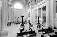
 Article by CBC News, February 22, 2018. "(We had to) get rid of the pieces that don't belong in the collection, the pieces that aren't significant, that aren't important." A comment from the Science and Technology Museum, Ottawa. The bench is from the former Union Station or Conference Centre in Ottawa. As I have said before I was employed at the Conference Centre during the early 1980's. I still remember the Grand Hall, the murals, a tunnel that connected the railway station to the Chateau Laurier, the furniture..Shame on you, whoever put a $4,000 dollar pricetag on my country's history; whoever removed this bench in the first place. Somebody had to profit from this misappropriation of cultural property.


National Capital Commission plans for 24 Sussex Drive.

I have a few questions: Why is the Department of Public Works not involved in this project? I noticed that the term deconstruction is used. Will the furniture be auctioned off? After the British government took over Earnscliffe on 140 Sussex Drive they sold Sir John A. Macdonald's furniture and artifacts on the front lawn:  The auction: Complete list of furniture, china and glassware, pictures, ornaments, etc. the property of the late Right Hon. Sir John A. Macdonald to be sold at Earnscliffe, Ottawa, May 15, 1982. (From: Earnscliffe Cultural Heritage Statement-City of Ottawa-Page 4/49, January 6, 2020.)

 Now the British High Commission is constructing a bunker that will hide the residence of Canada's first prime minister, and they are building high security gates. No wonder Sussex Drive is called "The Mile of Security" and not "The Mile of History."  Parks Canada and several Canadian prime ministers wanted the prime minister's home returned to the citizens of this country: "Earnscliffe should be considered a 'national shrine' and the government should 'investigate ways and means to acquire it for that purpose'". Parks Canada Record of National Historic Site Designation-Reference File-February 18, 2000.

Why does the government not have any control over the design of the Chateau Laurier Hotel addition? Before the Grand Trunk Railway built the hotel, they had to submit their plans to the federal government: House of Commons Ottawa July 6, 1908. Hon.William Pugsley (Minister of Public Works): "...Before giving a conveyance, we must have the plans submitted to us and approved by the government...The Governor in Council will not allow any departure from these plans unless, on the advice of our chief architect, we think they should be altered."

Why is the Department of Public Works inviting foreign entities to redevelop the Parliamentary Precinct? The I.M. Pei Company of New York City is on the short-list of contenders, they famously designed the Louvre pyramid in Paris:


Tuesday, March 16, 2021

A possible college or university course entitled "Heritage Properties in Canada."

 Curriculum. Federal laws that do not protect heritage properties: The National Capital Act; Heritage Railway Stations Protection Act; Canada Post Corporation Act; Broadcasting Act; Heritage Lighthouse Protection Act.

Historic buildings and infrastructure that faced wrecking crews: Toronto's Union Station; Ottawa's Union Station; Summerhill Station in Northern Toronto; the Rideau Canal from Ottawa to Kingston, Ontario; the Don Jail, Toronto; the Old Court House, 60 Queen Street West,Toronto; Ottawa Teacher's College, 195 Elgin Street;Royal Canadian Mint, 320 Sussex Drive, Ottawa; more than 70 % of the properties on the Experimental Farm, including the Booth Barn and Dominion Observatory;

Politicians who saved or tried to save Crown property: 1.) Prime Minister Pierre Trudeau:

1.) Created Harbourfront to preserve the Toronto waterfront as a green space. 2.) Refused to sell the Canadian National Railway hotels to the Hilton Corporation. The hotels are now owned by the multinational Fairmont. 3.)Expropriated properties on Wellington Street opposite Parliament Hill and the northern half of the Sparks Street Mall, to prevent the construction of residential towers and to preserve the buildings. 4.) Stopped the National Capital Commission from taking over 600 acres of the Central Experimental Farm for housing during the 1970's. 5.) Signed the UNESCO treaty to safeguard endangered buildings and landscapes. 6.) Promised that Canadians would always own the national parks:

House of Commons Ottawa  March 15, 1972. Hon. Martin O'Connell (Minister of Labour) Liberal: "There is a 50 percent increase in the area set aside in perpetuity for national parks. Canada leads all nations in the world in land set aside for future generations."

2.) Prime Minister Brian Mulroney - refused to transfer Stanley Park ownership from the federal government to the city of Vancouver, February 4, 1986, House of Commons. Created the designation "National Interest Land Mass" to keep Gatineau Park, the Greenbelt, Lebreton Flats, the Greenbelt Farm, Commissioner's Park, land beside the scenic parkways and Rideau Canal, etc. out of the hands of developers and the city. The prime minister halted the in-progress demolition of the Royal Canadian Mint, 320 Sussex Drive. Ottawa. (Susan Delacourt article.)

3.) Agriculture Minister John Wise never wanted the National Capital Commission to sell 91 acres of Agriculture Canada land, May 13, 1988, House of Commons Ottawa. 

4.)Toronto City Councillor Jack Layton-Tried to stop the demolition of the Spadina Roundhouse owned by the CNR. The Skydome was built on the grounds of the roundhouse.

5.) Toronto City Councillor Mike Layton prevented Larco from building residential towers on the Dominion Public Building on Front Street beside Union Station.The district is a Heritage Conservation Area protected by Part V of the Ontario Heritage Act. 

Kingston Penitentiary- Member of Parliament Ted Hsu; Kingston City Councillor Bridget Doherty; Kingston City Councillor Peter Glover.

Moffat Farm near Hog's Back and Mooney's Bay-Senator Anne Cools; Speaker of the Senate Noel Kinsella; Ottawa Mayor Bob Chiarelli and the council wanted to save the 88-acre Veteran's Affairs property as a parkland.

Architectural terms. infill; facadism; Gothic; Art Deco;Chateau; Baronial; Greek Revival.

Why is the Greber Report of 1950 so significant?

Name the Dominion Architects and the buildings they designed. The Dominion Architects were Thomas Scott; David Ewart; Thomas Fuller; Thomas W. Fuller; Edward Lewis Horwood; Richard Cotsman Wright; Charles D. Sutherland; Joseph Charles Brault; Edward Alexander Gardner; James Alfred Langford and Frederick Rebridge.

David Ewart designed the Connaught Building and Royal Canadian Mint, Ottawa; Sinclair Centre, Vancouver, BC; Dominion Observatory, Chief Astronomers Residence and Geodetic Survey Building on the Central Experimental Farm, Ottawa, and the Kingston Drill Hall, 100 Montreal Street,the Limestone City:

Princess Diana visiting the Kingston Drill Hall, 100 Montreal Street, Kingston, Ontario, 1991.

Heritage Preservation terms. Classified Federal Heritage Building; Recognized Federal Heritage Building; National Historic Site of Canada; UNESCO World Heritage Site; Ontario Heritage Act; Provincial Heritage Conservation District.

Describe the following terms and the importance of the Parliamentary Precinct; Confederation Square; Mile of History.

What is the National Interest Land Mass and why was it created in 1988? Name the NILM holdings.

Books pertaining to the architecture of Kingston, Ontario:


The definition of historic sites in Canada:

"...battlefields, forts and citadels, shipwrecks, archeological sites, cultural landscapes, bridges, houses, cemeteries, railway stations, historic districts, ruins, engineering marvels, schools, canals, courthouses, theatres and markets." (The Hon. Bryon Wilfert (Parliamentary Secretary to the Minister of the Environment, Liberal, House of Commons, October 26, 2004.) I would add-- aircraft hangars; the de Havilland Building in Toronto; the former Jarvis Street Toronto Headquarters of the CBC; correctional facilities in The Limestone City including Disneyland North, the Collins Bay Institution; the Gulf of Georgia Cannery, Richmond, BC and Glebe Collegiate, Ottawa.---savecfbrockcliffe.  

Sunday, March 14, 2021

City of Ottawa temporary buildings.

Front page of the Ottawa Journal, October 5, 1977.

 During the Second World War many temporary buildings were constructed---on Green Island; Wellington Street where the Library and Archives are now located; beside the Supreme Court of Canada; between the Daly Building and Revenue Canada Headquarters.

Temporary buildings 6 and 9 were on Sussex Drive where the American Embassy is now located. Building number 5 was on the Dow's Lake parking lot and number 8 was on the Experimental Farm//Queen Juliana Park.

After the Dow's Lake and Experimental Farm offices were demolished the government of Canada promised that the land would always be an open space:

House of Commons Debates Ottawa June 16, 1958. Hon. George James McIlraith (Ottawa Centre) Liberal: "Mr. Chairman, I wonder if the minister is now prepared to make the statement he said he would make concerning the policy of the government with respect to buildings on the central experimental farm."

The Hon. Charles Howard Green (Vancouver Centre) Minister of Public Works; Leader of the Government in the House of Commons; Progressive Conservative House Leader; Progressive Conservative: "The policy is that no buildings will be built on the central experimental farm except buildings for the Department of Agriculture."

Mr. Mcilraith: "If I may pursue the question a bit further, has the minister come to any conclusion as to what will be done with the land on the experimental farm when they are removed?"

Mr. Green: "I take it that the hon. member for Ottawa West refers to temporary buildings Nos. 5 and 8. For some years the policy has been when the temporary buildings are torn down nothing will be constructed on the site."

Mr. McIlraith: "I want to commend the minister for continuing the policy set out a few years ago  by the Liberal administration in that regard."

Temporary buildings No. 8 (the Experimental Farm) and No. 5 (Dow's Lake) are visible. Once they were removed, no other buildings were permitted to replace them. Eric Darwin-West Side Action photo.


This is what the Mayor, local politicians and the National Capital Commission envision for Dow's Lake and the Farm. Image is from "Reimagine Ottawa" by Clive Doucet. The land has already been rezoned from "Open Space" to "Mixed Use."

This property was untouchable, according to Canadian Prime Minister Louis St-Laurent; Federal Minister of Public Works Howard Charles Green; the Hon. George McIlraith and the document "The Central Experimental Farm National Historic Site Management Plan (7 of 20), Government of Canada and Agriculture and Agri-Food Canada.":
"Parks Canada's Rideau Canal Management Plan serves as a key land use planning document for lands situated in the immediate vicinity of the Rideau Canal National Historic Site i.e. CEF lands abutting Dow's Lake and the Rideau Canal."
"In particular, back shore land use and development is expected to protect open space and ensure compatible activities with the historic character of the Canal."
"Views to the Canal from the Arboretum from other lands east of Prince of Wales Drive are also to be protected."
Queen Juliana Park was the location of Temporary Building No. 8.


Saturday, March 13, 2021

"Parks do not have to be grassy to be be green."

Recreational Land Strategy for Ottawa 2006-2031. 

4.4.2. Parks and Open Spaces-"The City's requirements for parks and open spaces may have to be revisited to ensure that the types of spaces required of developers reflect the need for quality spaces of all sorts (active, passive, programmed, soft-surface and hard-surface) at the right location, and at the right sizes. The goals of a review of parks and recreational land should be: "Quality over quantity of space should be the guiding principle". Parks don't have to be grassy to be green. One of the many appropriate types of public green space is the plaza. Sized right and positioned at the heart of a community, it becomes a genuine focal point. The city should accept parkettes as part of the 5% parkland dedication." (Note: A parkette or a pocket park is less than 0.5 hectares in size-savecfbrockcliffe.)

No, city of Ottawa, our children and grandchildren will not play in parkettes, not when they are surrounded by thousands of acres of greenspace---the Experimental Farm (1,000 acres); Ev Tremblay Park; the 22-acre Commissioners Park; the 2,000 plus acre Greenbelt Farm; Lebreton Flats...

Recreational centres may be sold for housing, and the Dalhousie Community Centre in Chinatown was recently given away for a dollar. Park land is rarely preserved--- the Humane Society land on 101 Champagne; Moffat Farm near Mooney's Bay; embassies are being constructed in Mechanicsville; apartments are being built on Rochester Field near Maplelawn on Richmond Road and the 100-acre Rideau Hall grounds are off-limits. Major's Hill Park encompassed more than 20 acres before the Chateau Laurier built their parking garage, and the National Capital Commission sold Major's Hill Park land to the American Embassy during the mid-1990's.

The former Dalhousie Community Centre,755 Somerset Street West.CBC News photo.

"Worthless real property."

 "...At the end of 25 years taxpayers will not have to deal with what they have been dealing with for decades and that is worthless real property." (House of Commons Evidence-OGGO Committee, December 10, 2007.)

Skyline Campus, 1400 Merivale Road, Ottawa, Ontario. Built on the grounds of the Central Experimental Farm.

 Laurentian High School was demolished.The 91 acre decommissioned Farm property includes a Walmart and a subdivision.


Thomas D'Arcy McGee Building, 90 Sparks Street, Ottawa.


Joseph Shepard Building, 4900 Yonge Street,Toronto, Ontario.


Canada Place, 9700 Jasper Avenue, Edmonton, Alberta.


Douglas Jung Building, 401 Burrard Street, Vancouver, BC---returned to the government of Canada.


Harry Hays Federal Building, 220 4th Avenue SE, Calgary, Alberta.

House of Commons Debates Ottawa 2007.
March 19, 2007. MP Peggy Nash (Parkdale-High Park, Toronto, NDP.) "Mr. Speaker, the government's sell and leaseback scheme for federal buildings across the country is illogical. The scheme is going to hurt hard-working Canadians who pay taxes and who will now be on the hook for these arrangements for years and years to come. I wonder if the minister thinks that it makes good economic sense to sell his house and lease it back from the new owners for 25 years."

October 24, 2007. MP Charlie Angus (Timmins-James Bay, Ontario, NDP): "Mr. Speaker, this scheme was cooked up by the Liberals and is being carried out by the Conservatives and what we are looking at is an elaborate accounting shell game where they are going to bring in $1.4 billion now and it is going to cost taxpayers $3 billion. For example, there is the Harry Hays building in Calgary. Right now it costs taxpayers $5 million a year to maintain. Once it is sold it will cost taxpayers $20 million to maintain. Who is getting ripped off here? It is the Canadian public. Where is the accountability?

October 31, 2007. MP Diane Bourgeois (Terrebonne-Blainville, BQ.) "Mr. Speaker, today is a very sad day. Today, the sale of buildings belonging to taxpayers will be finalized even though the members in the committee and public service unions are against it and despite the request for a moratorium on this sale. This government is transferring ownership, through a leaseback agreement, of several very valuable federal buildings. This transaction will cost taxpayers tens of millions of dollars and the government will lease the premises for 25 years....We are entitled to ask who is profiting from this sale."
RCMP Headquarters, 4225 Dorchester Blvd., Westmount, Montreal Quebec.


The Sinclair Centre, 757 West Hastings Street, Vancouver, BC. Designated a Classified Federal Heritage Building on July 15, 1983 by Prime Minister Pierre Trudeau. The Prime Minister named this building to honour his father-in-law the Hon. James Sinclair. The Sinclair Centre was returned to the government of Canada.


Revenue Canada Headquarters, 305 Rene-Levesque Blvd., Montreal, Quebec.

Sunday, March 7, 2021

Are these buildings really "Secondary National Symbols?"

The East Block of Parliament, Ottawa, Ontario, Canada.

The West Block of Parliament.

The Supreme Court of Canada, 301 Wellington Street.The City of Ottawa is buying Supreme Court of Canada land and other sections of Parliament Hill for their Light Rail Transit. (Google:NCC Board"Tram preference on Wellington, new pathways for LeBreton..." by Jon Willing, Ottawa Citizen,January 21,2021.)


The Confederation Building, 229 Wellington Street.Wikipedia photo.

"The Supreme Court, Confederation Building and East and West Block and other Secondary National Symbols are afforded the second level of visual protection. The silhouette of background buildings may rise above the roofline of the Secondary National Symbols." (Page 96/153, Canada's Capital Views Protection.)
OTHER SECONDARY NATIONAL SYMBOLS IN THE CAPITAL
The National Gallery
Notre-Dame Cathedral
Museum of History
Chateau Laurier Hotel

 (Information is from "New Tools for View Controls in Canada's Capital 2016",page 37/76.)
   The Mayor and several members of City Council will probably support the hotel owners, if Larco wants to add 10 or more storeys to the Chateau Laurier extension:
 This is what former Somerset Ward/Little Italy Councillor Diane Holmes told David Reevely:
 "The Development Review Services is responsible for processing development applications. It has become increasingly apparent that this branch no longer represents the citizens or neighbourhoods of this ward. Rather, this branch represents the interests of the development industry. Input from the public is generally disregarded because this branch considers residents comments NIMBY comments."

     "The branch provides support to any application with little or no recognition of the neighbourhood wants or needs...You want to add 10 extra storeys on your building? Fine by us. You don't want to provide visitor parking? Use street visitor parking instead. Too many trees in front of your building? No problem, we'll remove them." ("Diane Holmes whacks the city's planning department" by David Reevely, Ottawa Citizen, May 19, 2014.)
--------------------------------------------------------------------------------------------
  Legal Title-Parliament Hill, House of Commons, Ottawa-December 21, 1963.
--------------------------------------------------------------------------------------------
Senate Bill S-203, an Act to amend the National Capital Act.
----------------------------------------------------------------------------------------------
Prime Minister of Canada John Diefenbaker is greeting Her Majesty Queen Elizabeth 11 at the Chateau Laurier Hotel, Ottawa, Ontario. October 1957. Archives of Canada photo.

The Chateau Laurier addition ignores official guidelines.

 Glossary of terms that pertain to the hotel, Major's Hill Park and the Rideau Canal:

Blanket Height Control-A view protection tool that establishes a single and broadly applicable maximum permitted height of any new development within a designated area. Usually listed in metres above ground or metres above sea level.

Buffer Zone - An area of land designated for view protection achieved by utilizing various planning tools such as height limits, zoning and/or development restrictions.

Central Capital Landscape- The symbolic centre of the Capital Core, including the Parliament Buildings as well as the Supreme Court, Major's Hill Park, and green space on the Gatineau waterfront.

Cultural Landscape-A geographic area, including both cultural and natural resources exhibiting cultural or aesthetic values.

National Symbols-The Parliament Buildings and other major public buildings and physical landforms within the Parliamentary Precinct and around Confederation Boulevard.

View Controls-A set of policies and/or guidelines that aim to protect views of national symbols, natural features, or other landmarks. (The glossary is from "New Tools for View Controls in Canada's Capital-2016", page 28/76.)

"When determining the heirarchy of view protection policies, it is important to note that there are additional secondary national symbols within the Central Capital Landscape whose views are to be protected, preserved and enhanced. This includes national symbols on both sides of the Ottawa River such as the National Gallery, the Notre-Dame Cathedral, the Museum of History, the Supreme Court and Chateau Laurier." ("New Tools for View Controls in Canada's Capital-2016",page 37/76.)

House of Commons Debates Ottawa November 26, 1909. Regarding the Chateau Laurier Hotel.

Mr. George Eulas Foster (Conservative) "This is the first vote for the construction and we would like to know what the proposed buildings are to cost, what their capacity and what use they will be put to."

Mr. William Pugsley (Minister of Public Works) Liberal: "...The building will have one frontage on Sussex street and another on Major Hill park, length 590 feet and width 250 feet; two large courts 154 by 79; the building will have six stories and a basement on the park and seven stories and a basement on Sussex street; it will be 125 feet high on MacKenzie avenue and 150 feet high above Sussex street; the centre of the building will face York street which is quite a wide street. The lower end of the building will be 503 feet from St. Patrick street and the upper end 247 feet from the Lindsay property. It will be built of stone."

Mr. Foster: "What kind of stone?"

Mr. Pugsley: "Something similar to that in the Museum."

(Note: The National Capital Commission refuses to become involved in the Chateau Laurier debate because "the hotel is private property." However:

1.) The Grand Trunk Railway was a private corporation in 1908 and 1909, when it was negotiating for land on the federal Major's Hill Park. The park was part of Parliament Hill.

2.) The federal government had the power to approve or reject the Grand Trunk hotel architectural designs.

3.) The hotel parking garage did not obliterate views of the Chateau Laurier from Major's Hill Park. The new addition, built on the grounds of the garage, will obstruct views of the Chateau from Major's Hill Park. It will also remove sightlines of the Rideau Canal and Parliament Hill from the Mile of History.

4.) Why is the City of Ottawa involved in this project and not the Governor General of Canada, Senate of Canada, Public Works, National Capital Commission and Federal Department of Heritage? This is not a delapidated barn we're talking about---the hotel is a National Historic Site of Canada; protected by Part 1V of the Ontario Heritage Act; a former Canadian National Railway property; the Canada pavilion at Epcot in Orlando, Florida is a replica of the castle; Prime Minister Pierre Trudeau refused to sell the CN hotels to Hilton during the 1970's and television shows and movies are filmed here ("Little Gloria, Happy at Last").

5.) Does anyone even care about the fact that the designation "UNESCO World Heritage Site" will be removed from the Rideau Canal if the extension is built?

Saturday, March 6, 2021

The NCC and the City of Ottawa are not protecting important views.

The Centre Block of Parliament and the Hill.

  High rise office buildings may be constructed on the Hill." At least the upper part of the silhouette of the Centre Block will remain unobscured...The Supreme Court, Confederation Building and the East and West Block and other Secondary National Symbols are afforded the second level of visual protection. The silhouette of background buildings may rise above the roofline of the Secondary National Symbols." (From: Canada's Capital Views Protection, page 96/153.) The image is from CBC News, June 18, 2020.
 
The Lebreton Flats. House of Commons Debates November 23, 1967. The Hon. George McIlraith (Minister of Public Works) "...The LeBreton Flats were envisioned as a western extension to the Parliamentary Precinct. Buildings on or near the Parliamentary Precinct cannot be any taller than the Peace Tower."

 Chateau Laurier Hotel During the year 1969 Major's Hill Park land was expropriated to build a hotel parking garage. Now the garage has been torn down and a modern addition is being constructed on the site. The addition will block views of most of of Canada's Castle from Major's Hill Park. "I might point out that there will be a fine view from the parliament grounds of the back premises of the hotel." MP George William Fowler, House of Commons, July 6, 1908.

Experimental Farm  Hundreds of Experimental Farm trees are being clearcut, eventually, to accomodate a brand new medical centre. Former Ottawa mayors Jim Durrell and Jacquelin Holzman sent an open letter to the National Capital Commission about the loss of trees: Hundreds of trees would need to be cut down. Yes,we counted, but we stopped at 500! (From:"NCC Federal Site Review for the New Civic Campus at the Ottawa Hospital" October 21, 2016, Page 215/256.)

Also, the Greenbelt Alliance of Canada's Capital said that all of Isabella Preston's crabapple trees that line Prince of Wales Drive are endangered because the Drive is being widened. On March 1, 2021 Canada Post honoured the work of the horticulturalist and her successors:  OTTAWA, ON, March 1,2021/CNW/ Today Canada Post released the last in its popular flower series, a two-stamp issue showcasing the blossoms of crabapple tree cultivars with a Canadian distinction, the Malus 'Rousseau' and Malus 'Maybride'. The pretty pink flower of the Malus 'Rosseau' bred by renowned ornamental plant breeder Isabella Preston was first introduced at the Central Experimental Farm in 1928.

March 1, 2021 stamps that were issued by Canada Post.

An August 18, 1977 Ottawa Journal article.

House of Commons Ottawa February 9, 1998. MP Marlene Catterall (Ottawa West-Nepean) Liberal: Mr. Speaker, last week the Secretary of State for Parks and the minister of agriculture designated the Central Experimental Farm in Ottawa as a national historic site."
"That does not mean the farm will be frozen in time. It will continue to evolve as it has for 111 years but it will evolve in a way that is consistent with the important contribution it has made to agriculture in Canada and internationally."
"It will be a permanent reminder in the nation's Capital and to all Canadians of the importance of agriculture to our economic and social development. The people of this region are proud of the nation's Capital and it's national institutions. I know they will want to contribute to and be part of planning the Central Experimental Farm, our newest national historic site."

Earnscliffe, 140 Sussex Drive.

Ottawa River, Rideau River and Rideau Canal - The Greber Report of 1950 insisted that the National Capital Region was so so vast, that land adjacent to waterways was not necessary for housing or commercial development.
House of Commons Ottawa March 24, 1986. MP Jean-Robert Gauthier (Chief Opposition Whip, Whip of the Liberal Party) Ottawa-Vanier: "...My question is directed to the Deputy Prime Minister. Will he tell the House if it is federal policy to sell federally owned parklands? The NCC chairman...recently said she wants to sell part of an Ottawa riverfront park known as Mile Circle, to the United States of America for an embassy compound."
"...Mr. Speaker, could the Deputy Prime Minister inform the House whether it intends to act responsibly and give clear and precise instructions to all those who are responsible for our national parks, indicating clearly that none of our national parks are for sale." (Note: In the year 1925 the Ottawa Improvement Commission designated the Mile Circle near Rockcliffe a national park---MP Barry Turner (Ottawa-Carleton) House of Commons, April 9, 1986.)

The Greenbelt - A letter to Ottawa Mayor Jim Watson regarding the Mer Bleue Bog: "Dear Mayor Watson: CPAWS Ottawa Valley has long focused on the preservation of Ottawa and the surrounding ecological integrity, natural beauty and diverse species. It is as a CPAWS supporter that I learned of the proposed changes to the Greenbelt. As a resident of the National Capital Region, the Greenbelt is important to me...Mer Bleue is the most biologically diverse area in Eastern Ontario, an internationally recognized RAMSAR site and and living laboratory where scientists from around the world come to  learn about climate change, bogs and the species which depend on them."

Part of an August 24, 2019 letter to the Ottawa Citizen, regarding residential expansion into the Greenbelt: "The City of Ottawa recently released its discussion paper "5 Big Moves" as part of its Official Plan Review...Much of it is laudible, but Policy 3 under Growth Management is not. The policy states: 'Where urban expansion may be required in the future...consider the potential to expand into the Greenbelt.' Whoa! Ottawa is already at one million people and expected to grow more, but nowhere are they manufacturing any more greenspace...Once you permit urban development of the Greenbelt that greenspace is lost forever...In short, don't bother considering this option." Alex Cullen, Ottawa.